


Page 28 - 2417
P. 28
Page 4 of 23                                                  Chaib et al. Carbon Footprints 2026, 5, 23


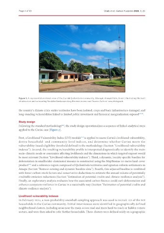
               Figure 1. A representative street view of the Curiaú Quilombola community, Macapá, Amapá State, Brazil, illustrating the built
               infrastructure and surrounding floodplain landscape along the main access road. Source: Authors’ own photograph.


               the country’s climate crisis: entire territories have been isolated, crops and basic infrastructure damaged, and
               long-standing vulnerabilities linked to limited public investment and historical marginalization exposed [47,48] .


               Study design
               Following the standard methodology , the study design operationalizes a sequence of linked analytical steps
                                              [42]
               applied to the Curiaú case [Figure 2].

               First, a Livelihood Vulnerability Index (LVI) module  is applied to assess Curiaú’s livelihood vulnerability,
                                                            [43]
               derive household- and community-level indices, and determine whether Curiaú meets the
               vulnerability-based eligibility threshold defined in the methodology (Section “Livelihood vulnerability
               indexes”). Second, the resulting vulnerability profile is interpreted diagnostically to identify the main
               socio-climatic needs or constraints affecting livelihoods and the dimensions in which targeted support would
               be most relevant (Section “Livelihood vulnerability indexes”). Third, a dynamic, locality-specific baseline for
               deforestation in smallholder-dominated mosaics is constructed using the MapBiomas 10-metre land-cover
               product  and a reference region composed of Quilombola territories and agrarian-reform settlements in
                      [49]
               Amapá (Section “Remote-sensing and dynamic baseline data”). Fourth, this adjusted baseline is combined
               with forest carbon-stock factors and conservative deductions to estimate the annual volume of potentially
               creditable emission reductions (Section “Estimation of potential credits and climate-resilience analysis”).
               Finally, an exploratory analysis evaluates how the associated carbon finance could curb deforestation and
               enhance ecosystem resilience in Curiaú in a sustainable way (Section “Estimation of potential credits and
               climate-resilience analysis”).


               Livelihood vulnerability indexes
               In February 2024, a non-probability snowball sampling approach was used to recruit 123 of the 505
               households in the Curiaú community. Initial interviewees were identified in geographically defined
               neighborhood clusters, including areas near the main access road and more hard-to-reach or hidden remote
               sectors, and were then asked to refer further households. These clusters were defined solely on a geographic

